This hiking map is based on data from © OpenStreetMap (As of: 28.07.2019).
With the purchase you acquire a PDF file with the following content:
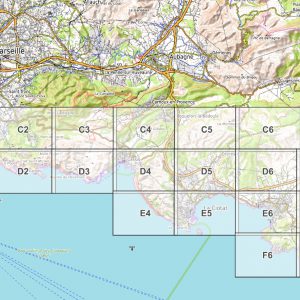
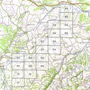
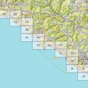
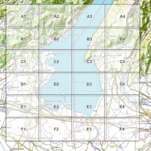
- 20 pages of map material for self-printing in A4 format, map scale 1: 25.000
- 1 additional overview page (= index, see preview image)
- The route of the following long-distance hike is shown: Coastal walk Malta and Gozo (6 days).
Extra Content: In addition to the PDF hiking map, you will receive two high-resolution PNG image files with a resolution of 14.043 x 9.933 pixels for both islands as a file download (that's 133 megapixels each!). This corresponds to a scale of 1: 15.000 (Gozo) or 1: 25.000 (Malta) when printing on A0 with 300 dpi. The PNG files are also suitable for creating your own cutouts in high quality and resolution (requires a suitable image editing program such as the free program IrfanView). The PDF hiking map covers the entire island of Malta and the entire island of Gozo (see preview image) and is designed for the following long-distance hike: www.wanderndeluxe.de / long-distance hike / kuestenwanderung-malta-gozo-coastal-walk-6-days /.
Notes: The hiking map in the pdf file is colored, but clearly legible as a black and white printout. Recommended printer setting: 300 dpi, printing on A4 without scaling. The use of the hiking map and the use of the marked routes are at your own risk.