When planning a long-distance hike, you always come across the same problems: How exactly does the route run? What is the best way to cut the daily stages? Where can I find suitable accommodation?
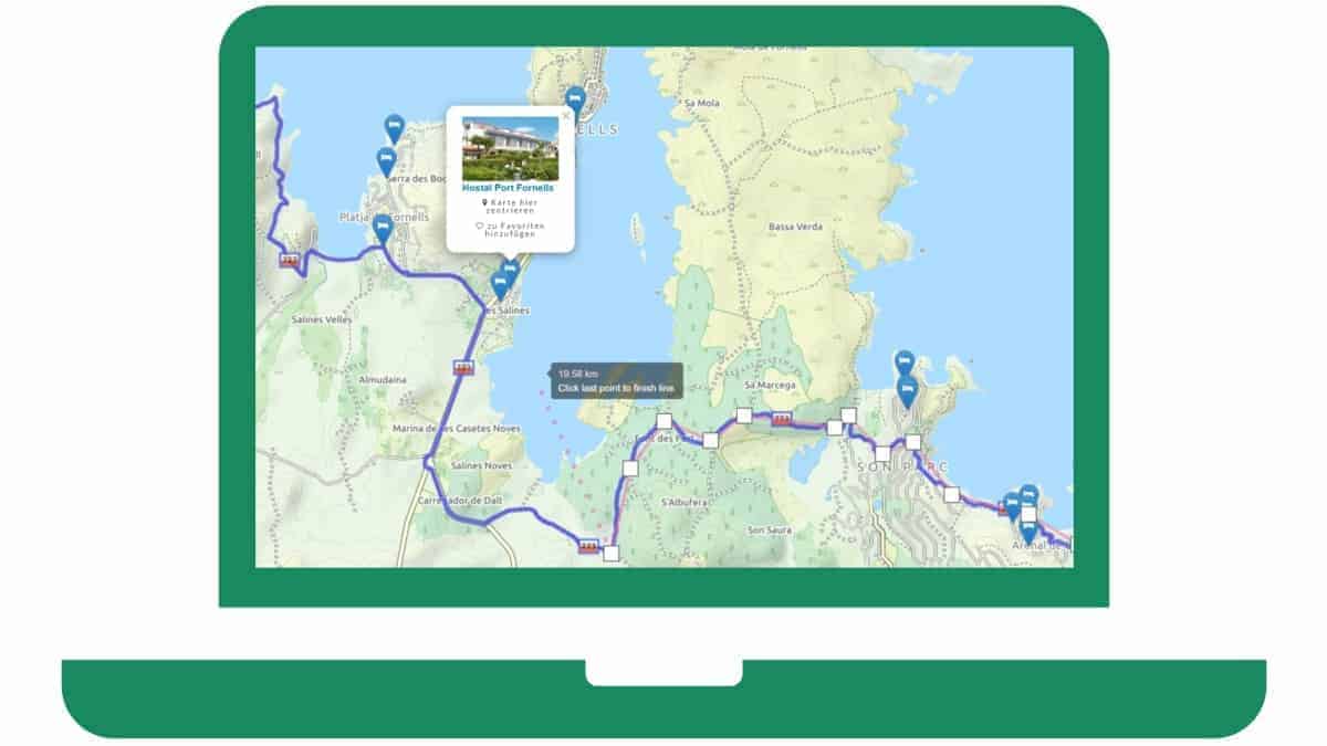
We have therefore developed an interactive map tool that makes planning a multi-day tour significantly easier! It helps us a lot to plan our own long-distance hikes.
Try our long-distance hiking planning tool for your own routes! The interactive map includes hiking trails and accommodations across Europe:
Accomodation
Quick start Guide:
With the help of this interactive map you can Discover hiking trails and find suitable accommodations and mark as favorites.
You can use the to estimate the distance Tape measure function use. In order to calculate the approximate hiking time from this, the altitude and the altitude also play a role (see Hiking time calculator).
You can make an approximate estimate using the following table:
(To simplify matters, we assumed in the table that the same number of vertical meters must be mastered on the ascent as on the descent)
You can use the to estimate the distance Tape measure function use. In order to calculate the approximate hiking time from this, the altitude and the altitude also play a role (see Hiking time calculator).
You can make an approximate estimate using the following table:
| height meter (each time and descent) | Distance in km | |||
|---|---|---|---|---|
| 10 km | 15 km | 20 km | 25 km | |
| 0m | 03:00 | 04:30 | 06:00 | 07:30 |
| 250m | 03:48 | 05:18 | 06:48 | 08:18 |
| 500m | 04:42 | 06:06 | 07:36 | 09:06 |
| 750m | 06:18 | 07:03 | 08:24 | 09:54 |
| 1000m | 07:54 | 08:39 | 09:24 | 10:42 |
| 1250m | 09:30 | 10:15 | 11:00 | 11:45 |
Accomodation
Suitable accommodations are loading ...
Accomodation
My favorites
You haven't saved anything here yet.
In the map or in the list view you can find accommodations by clicking on the choose.
Your favorite accommodations will not be saved permanently, but will be lost as soon as you leave or reload this page.
Accomodation
Tool info:
This interactive map is still in the status of a so-called beta version. This means that not all functions have been fully developed yet.
Known Limitations:
The accommodations shown are based on a list as of 2016. Newly opened accommodations are therefore not on the map. It can also be the case that accommodations are shown on the map that no longer exist. We are working on an update of the accommodation database!
We are happy to accept errors and feedback! See contact options Imprint
The most important functions at a glance
- To display GPX or KML files: If you already have a completed hiking route in the form of one or more GPX or KML files, you can load them onto the map one after the other or all at once. The button on the top left of the map is used for this. The maximum file size is limited to 1.000 KB.
- Marked hiking trails: All marked hiking trails are shown on the map. Among other things, you can follow the route of the red and white marked GR long-distance hiking trails on the map (provided based on the data from WaymarkedTrails).
- Distance measurement: The tape measure function helps to estimate distances. With just a few clicks, you can also measure winding routes. The tape measure icon on the map activates the odometer. When planning a tour, also remember to not neglect the altitude of your route (contour lines on the map).
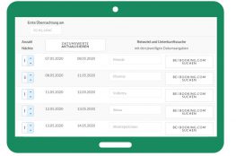
- Accommodations: The map loads accommodations for the current map section in the background. With each map movement (zoom or move) the displayed accommodations are updated (based on data from Booking.com). The accommodations are displayed as a list in the sidebar and as a map pin. The sidebar can also be folded in - then there is more space for the map on the screen.
- Favorites list: If you want to remember certain accommodations, you can save them in a favorites list. Attention: The favorites list is not saved permanently, but is lost as soon as the page is reloaded or exited.
Tip: Our map works best on a PC and in full screen view. The full screen view is activated with the following icon: ![]()


1 December 2019
Hello Frank,
that seems like a great tool! Can I download this or better asked, how can I try this with my own route planning?
Best regards,
Jürgen
2 December 2019
Hello Jürgen,
Thanks for the feedback and suggestion! Downloading is not possible, the tool is only available on the website. Today I have built in a function with which you can load your own hiking route into the map (GPX file format or KML file format). You will find the button for this in the map at the bottom left. If you have a route that consists of several different files, you can also select several files at the same time and display them on the map.
Regards
Frank